
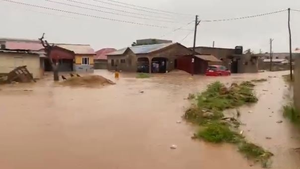
The increasing encroachment on wetlands, river channels and natural flood retention areas is a major driver of the recurrent flooding experienced across Greater Accra, according to technical findings presented by Dr. Kwadwo Ohene Sarfoh, Coordinator of the Greater Accra Resilient and Integrated Development (GARID) Project.
Presenting an assessment during Friday’s government briefing on post-flood mitigation efforts, Dr. Ohene Sarfoh said years of unregulated development have significantly reduced the natural capacity of rivers and wetlands to absorb stormwater, leaving communities increasingly vulnerable to flooding.
Using satellite imagery and spatial analysis covering several river basins and wetlands, he demonstrated how rapid urban development had transformed key flood-prone areas over the past two decades.
The presentation showed extensive development along the Akuapem Ridge, where vegetation has been cleared to make way for buildings, increasing erosion and causing large volumes of silt to be washed downstream into Accra’s drainage systems.
Dr. Ohene Sarfoh also highlighted significant losses of wetlands in areas including Tetegu, Mallam, Sakumono and the Densu-Weija Basin, where land that previously served as natural water retention zones has been reclaimed for residential and commercial developments.
“The city does not have enough space for water to pond to allow for the runoff not to disturb settlements,” he said.
According to him, developers frequently fill wetlands with solid waste and laterite during the dry season before constructing buildings, permanently eliminating areas intended by nature to accommodate excess floodwater.
One of the most striking examples presented involved the Korle stream, which feeds the Kpeshie Lagoon.
Dr. Ohene Sarfoh revealed that the width of the watercourse had reduced dramatically over the years—from 261 metres in 2002 to just 10.6 metres in 2026.
“When it rains and people are complaining that it’s flooding, this is the kind of human behaviour that is leading to the situation that we are facing,” he said.
His presentation further showed that more than half of several wetland catchments, including parts of the Teshie Dam area and Sakumono Ramsar Site, have been lost to development.
An analysis conducted across 16 Metropolitan and Municipal Assemblies also identified more than 10,000 structures built within 25 metres of drains—areas that Ghana’s planning regulations require to remain free of permanent development.
The study found that approximately 16 per cent of legally protected drainage buffer zones in the sampled locations had already been lost to construction activities.
Video footage shown during the presentation captured trucks dumping solid waste into wetlands, buildings constructed directly along waterways, fuel stations located within drainage corridors and developments forcing rivers to change their natural course.
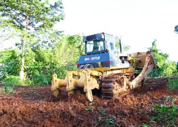
According to Dr. Ohene Sarfoh, these activities have severely constrained the ability of assemblies and engineering teams to dredge drains or undertake flood mitigation works because equipment can no longer access many waterways.
He noted that flooding cuts across all income levels because developments have occurred in high-, middle- and low-income communities alike.
“It’s a function of the whole society’s attitude and behaviour that is affecting everybody,” he observed.
He warned that unless wetlands, flood plains and drainage reservations are protected and existing planning regulations strictly enforced, the frequency and severity of flooding in the capital will continue to worsen despite investments in drainage infrastructure.
The presentation formed part of the government’s technical briefing outlining measures being implemented following the recent floods that affected several communities in Greater Accra and other parts of the country.


